
Talk to the Experts
As local experts on Maine waterfront property and real estate, we have been connecting Buyers and Sellers for over 14 years. This guide is a comprehensive source of information on Maine’s Waterfront Properties, including coastal, oceanfront, island, lakefront and riverfront properties – and provides a marketplace for these specific categories of real estate in Maine.
We have the experience and knowledge to assist you in thoroughly investigating the property and negotiating the best possible price and terms for you (sellers, not buyers, typically pay all commissions). To learn more about the five benefits of having us represent you, read about Buyers Brokers.
Find Your Perfect Maine Waterfront Property
Our specialty is providing buyers with an easy way to search for their Maine dream property by using our unique Question/Answer format.
WHY USE A BUYER'S BROKER?
Learn more about the five benefits of having us represent you.
BUYER'S TIPS
Ten valuable tips you should know before buying Waterfront Property in Maine.
FIND OUT HOW MUCH YOUR WATERFRONT PROPERTY IS WORTH
If you are considering selling, the first step is to get an idea of your property’s value.
Featured Waterfront Properties
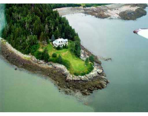
Machiasport Oceanfront
$ 950,000
Town : MachiasportMLS# : WP#2950000
location : Machias Bay
View Details
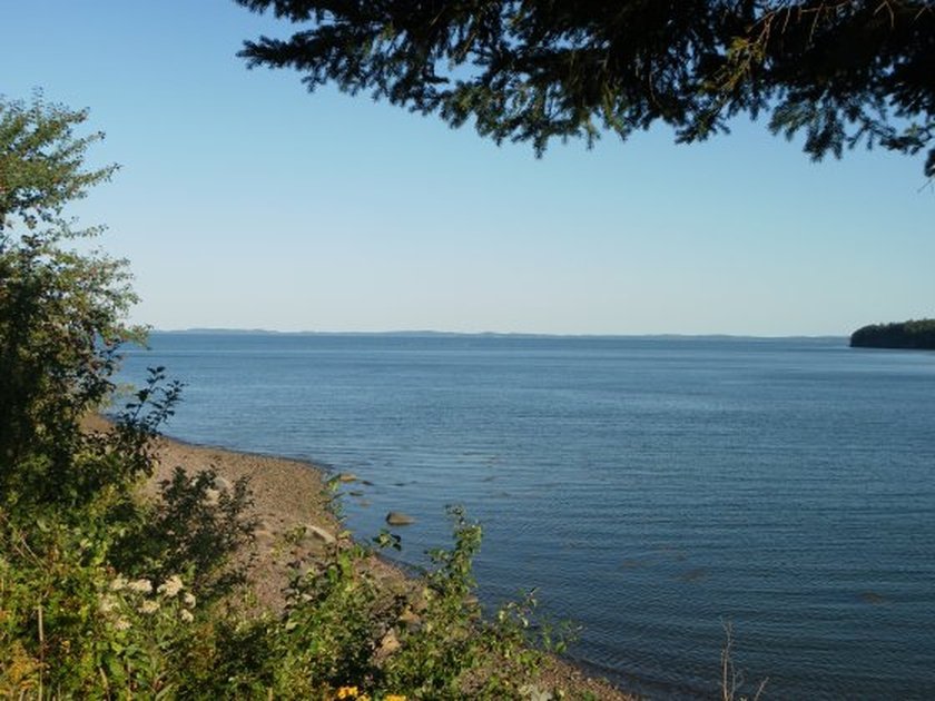
Passamaquoddy Bay
$ 198,000
Town : RobbinstonMLS# : MLS#120115
location : Passamaquoddy Bay
View Details

East Grand Lake property
$ 389,000
Town : WestonMLS# : MLS#1262307
location : East Grand Lake
View Details
Maine Waterfront Listings
Coastal
Properties

Lake & Pond
Properties

River & Stream
Properties

Island
Properties
